
Austintown Township ZIP Code Coverage
Only one postal reference is verified by the research: 44515. Austintown Township uses an Austintown, Ohio 44515 mailing address for township government, and the Austintown branch and post-office references use that same ZIP. That evidence supports 44515 as the township’s verified postal reference. It does not prove that every point in the township uses that ZIP, and it does not support adding a neighboring ZIP from a commercial map or list.
| Verified ZIP | Local reference | Post-office evidence | Record-search note |
|---|---|---|---|
| 44515 | Austintown postal label; township government and Austintown branch references. | The township lists the Austintown Post Office, 330-799-5061. | Verify each delivery address through USPS. The Auditor’s visible advanced form does not expose a ZIP field. |
No other ZIP, PO-box-only ZIP, unique ZIP, shared service area, or boundary line was verified in the official sources. The correct answer for an alleged additional Austintown Township ZIP is not a guess. Use the address-specific USPS result, then keep the parcel and township labels separate from the mail label.
Austintown Township ZIP Code Verification
The USPS ZIP Code Lookup is the authoritative route for a specific delivery address. Enter the full street address and use its standardized result only to confirm postal routing. A township name, nearby map pin, road name, or prior mailing label is not a substitute for that verification. The township covers substantial area, but the Census area and population figures do not establish USPS delivery boundaries.
The official USPS address lookup provides the address-by-address check required when a ZIP is uncertain.
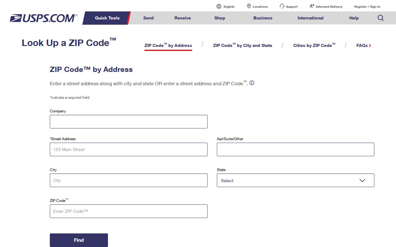
Keep the returned ZIP with the mailing record, then use the same street address and parcel information for any county property question. That sequence avoids treating a postal designation as legal land geography.
Austintown Township ZIP Code Workflow
A ZIP code can narrow a mail question, but an address-based record trail needs more than the five digits. The following sequence uses the verified local tools without claiming that they offer a ZIP-wide resident search. It starts with postal verification and ends with the custodian that holds the record actually being sought.
- Confirm the exact delivery address through USPS and save the standardized mailing result.
- Search the same address in the Mahoning County Auditor Property Search, omitting the street type as the official local directions require.
- Record the property location, parcel number, and legal description, rather than relying on the postal code alone.
- Use the Mahoning County GIS to orient the parcel, keeping its informational, non-survey status in mind.
- Use Recorder documents or historical locality material when a recorded transfer or older address trail is the real question.
Once an address is narrowed to a particular road, the Austintown Township street directory has the fuller parcel and deed-chain method. The ZIP code directory remains focused on postal confirmation and the mismatch between delivery labels and record systems.
Austintown Township ZIP Code Parcels
For land records, three separate locators should travel together. The property location, often called the situs address, identifies where the parcel is located. A deeded-owner or tax-payer address is a mailing or record-contact field that may differ from the situs and from each other. The legal description identifies the land for transfer research. A ZIP code belongs to postal delivery and should not take the place of any of those three parcel identifiers.
- ZIP code
- A postal delivery designation. It is not a township boundary, precinct, parcel number, or legal description.
- ZIP+4
- An added delivery-routing detail used with a ZIP code; it does not change the property’s legal description.
- PO-box ZIP
- A postal designation associated with post-office boxes. No Austintown Township example was verified in the research.
- Unique ZIP
- A postal designation assigned to a single organization or delivery arrangement. No local example was verified in the research.
- Carrier route
- A delivery route category, not a jurisdiction or parcel boundary.
The Auditor allows a parcel number with or without dashes or dots and asks users to include all zeroes. No official decoding legend for parcel-number segments was found. Search the exact parcel number shown by the Auditor, then compare its legal description with the recorded instrument instead of trying to infer a parcel from its ZIP.
Austintown Township ZIP Code Custodians
Austintown is a Mahoning County township, not an incorporated City of Austintown. Its local administration is at 82 Ohltown Road and the township’s General Information page identifies local contacts, including the post-office reference. The day-to-day township label is Austintown and the verified postal reference is 44515. Those facts do not move county records into a township office.
The core parcel, GIS, Recorder, Clerk, Probate, and vital-record offices are in Youngstown but serve Austintown Township. For example, a property record goes to the Auditor, a recorded deed goes to the Mahoning County Recorder, and map questions go to GIS. The county seat location changes the custodian, not the township identity of the land. Note: use the exact record type, street address, parcel number, and time period when contacting a Youngstown custodian.
The township general-information page shows the local civic contact layer that sits alongside the county record system.
That division is central to the ZIP code directory: postal labels may say Austintown, while the official property and court custodians are county offices in Youngstown.
Austintown Township DRC ZIP Limits
One state search does expose a ZIP Code field, but it has a narrow and important limit. The Ohio Department of Rehabilitation and Correction Offender Search allows ZIP Code with status choices, yet its residential county and ZIP information applies only to APA Supervision or Violators at Large and represents a last recorded address. It is not general proof that a person lives in Austintown Township and is not a general resident-search tool.
| DRC field | Form type | Verified limit |
|---|---|---|
| Zip Code | Text | Only for APA Supervision or Violators at Large, with last-recorded-address context. |
| Residential County | Dropdown | Has the same APA-supervision or VLA limitation. |
| Status | Radio choices | All, Incarcerated, Released, APA Supervision, or Violators at Large. |
| County of Commitment | Dropdown | County sent from, not necessarily residence. |
The county Board of Elections and Ohio DATA Act provide separate voter-record routes, but the research did not verify a public ZIP filter for the Mahoning individual lookup or the Auditor. Public voter material also excludes protected fields and confidential records. A ZIP match in any index is a limited, dated record fact, not a broad statement about current residents.
Austintown Township ZIP Code History
Historical labels can be more useful than a modern mailing assumption. The 1886–87 Polk directory used separate Austintown and West Austintown sections, while the current government name is Austintown Township. Earlier material can also sit under Trumbull County because Mahoning County formed in 1846. These changes in locality and county labels explain why a historical record may not use today’s township wording.
No official source in this research established a street-renumbering date, renamed-street conversion list, ZIP realignment, or postal-boundary change for Austintown Township. Do not create a number conversion or ZIP history from a map resemblance. For an older address, search the historical locality label, township, road intersection, and legal description alongside the current street name. The Mahoning Valley Historical Society and the Public Library of Youngstown & Mahoning County genealogy resources are the documented local research channels.
Austintown Township ZIP Code Boundaries
The key boundary rule is modest: ZIP Codes are postal delivery designations, not township boundaries, city limits, precincts, legal descriptions, or GIS survey lines. An Austintown mailing label can coexist with a Youngstown county-office address because the label and the custodian answer different questions. The GIS viewer can orient a parcel within county records, but the County expressly describes it as informational rather than a legal survey.
Address-first rule. Verify delivery with USPS, locate the property in the Auditor’s parcel roll, and use the legal description and recorded document for land questions. Do not infer a parcel, government jurisdiction, or a person’s current location from a ZIP code alone.
When a postal or property record appears inconsistent, retain the exact wording and date, then ask the custodian that controls the field. The Ohio Public Records Act provides the inspection and copy route for public county or township records, subject to redaction laws. USPS controls delivery verification; the Auditor controls parcel data; the Recorder controls recorded instruments. Note: a mismatch is a reason to compare the record types, not a reason to overwrite one with the other.
Austintown Township ZIP Research Gaps
The official evidence does not prove that 44515 is the only ZIP used throughout the township, and it does not identify another ZIP as serving it. It also does not establish a PO-box-only or unique local ZIP. That is why the ZIP code directory leads with a single verified reference instead of a complete-looking but unsupported list. USPS address verification is the proper fallback whenever an exact delivery question remains open.
The same restraint applies to record-search claims. The Auditor’s local form is address, owner, parcel, and advanced property search, not a verified ZIP filter. The GIS static page did not reveal a ZIP layer or a buffer tool. Building permit inquiry fields were not captured. A narrow request to the responsible office can seek a known address, parcel, township, and date range under the public-record rules without promising a search mode the research did not establish.