
Austintown Township Street Directory Walkthrough
For a named road, begin at the Mahoning County Auditor Property Search. The Auditor’s directions permit a full-street result: leave both house-number fields blank, enter the street name, and omit a suffix such as Street or Drive. The resulting list is a property-address inventory. It can lead to a parcel, but it is not a list of everyone living along the road. That distinction matters in a township where county offices, rather than a city assessor, hold the main land records.
- Run the whole-street address search and open a parcel that matches the address being researched.
- Save the parcel number, property location, legal description, sales information, and the two address fields shown on the parcel card.
- Use the owner and acquisition clues with the Recorder’s document index, comparing legal descriptions before treating two transfers as the same property.
- Use the map only to orient the parcel, then return to the Auditor and recorded documents for the record details.
- Use a Board of Elections route or a properly obtained dated voter file only within Ohio’s public-record limits.
A street-by-street search changes shape when it reaches a historic household question. The 1886–87 Polk volume is a known local example, but it is publication-specific. Historical directories and census evidence can support a time-bound inquiry after the parcel or locality is verified; they do not convert a present parcel list into a current household roster.
Austintown Township Auditor Street Search
The Auditor is the practical starting point for an Austintown Township address search because its official instructions describe both a single-address search and a whole-street search. A house number and street name locate one address. For the wider result, keep the number boxes empty and enter the street name without the written street type. Partial owner and quick searches are also supported, but a name result should be checked against the property location and parcel number before it is used as a land lead.
The portal describes its data as current processed property information and does not state an online historical starting year. Advanced search can combine sales, location, land, and residential criteria, and its results can be exported to CSV. Those extra filters can narrow a property question, but they do not establish occupancy. A dated record card and the recorded instrument remain the stronger evidence when a street result needs confirmation.
Austintown Township Street Search Fields
The Auditor’s documented fields make the local street-search workflow repeatable without guessing at a live form. All of the primary address fields are optional. The quick-search box accepts a full or partial parcel number, owner last name, or address. Street type words should be omitted from the street-name entry; a separate abbreviated street-type field is shown for searches that use it.
| Auditor field | Entry type | Street-search use |
|---|---|---|
| Search by Parcel, Owner or Address | Text | Accepts full or partial parcel, owner last name, or address. |
| House # | Text | Leave the house-number fields blank for the full-street result. |
| Direction (Abbv) | Text/select-style | Use an abbreviated direction when applicable. |
| Street Name | Text | Enter the road name without Street, Drive, Lane, or a similar suffix. |
| Street Type (Abbv) | Text/select-style | A separate abbreviated field; do not invent its live option list. |
| Parcel Number | Text | All zeroes are included; dashes and dots are optional. |
| Owner Name (Last First) | Text | Partial last name, last name with initial, or last name with first name are accepted. |
Sales date and price ranges, buyer and seller names, location dropdowns, acreage, year built, living area, and bedroom or bath ranges appear in the advanced interface. The official materials do not expose every dropdown option, so the safe approach is to use only the visible choices at the time of search. Note: a whole-street result is a parcel list with a current-data context, so retain the date checked with any result.
Austintown Township Parcel Address Records
A selected parcel card gives the address search more useful detail, but its labels need to be read exactly. The property location identifies the situs, while the Deeded Owner Address is the last recorded owner-document address. The Tax Payer Address is where tax correspondence is mailed. Those two addresses may differ, may be outside the township, and neither is proof that the named person occupies the property or that every person at the situs appears on the card.
| Parcel number and location | Connect the selected result to a specific property record and site address. |
|---|---|
| Legal description | Supplies the land description that should be compared across deed records and parcel changes. |
| Deeded Owner Address | The address on the last recorded owner document, not a statement of all residents. |
| Tax Payer Address | A correspondence address that can differ from the deeded-owner address and situs. |
| Sales and tax data | Shows recorded transfers, values, tax charges, payments, assessments, and related parcel context. |
The same card can show valuation history, improvement and land information, a sketch or exterior dimensions, a map panel, and a printable property-record card. It does not document a residential-occupant roster, utility account, renter list, or complete household list. Treat the person named there as a recorded owner or tax contact as of the record date, then verify the underlying deed when the relationship to the parcel matters.
Austintown Township Street Records Coverage
Several offices touch an Austintown Township address, but each one answers a different question. The address-record chain works best when the parcel number and legal description travel with the search. That keeps a road-name match from being mistaken for a title match, especially where a parcel has split or a mailing address has changed.
| Address record | Local keeper | What it can establish | Access and limit |
|---|---|---|---|
| Parcel page | Mahoning County Auditor | Parcel, property location, owner and tax-contact fields, legal description, sales, values, and tax links. | Free address, owner, parcel, and advanced searches; not an occupancy list. |
| Parcel map | Mahoning County GIS | Approximate parcel geography and map context. | Free viewer; informational only and not a legal survey. |
| Recorded documents | Mahoning County Recorder | Recorded parties and a land-document trail. | Enrolled Laredo service reaches 1980 to present; counter research is an alternative. |
| Permit or inspection material | Mahoning County Building Inspection | Address-specific work or inspection records if responsive. | Portal fields and online coverage were not verified; use the department or public-record request path. |
| Public voter material | Mahoning County Board of Elections | Public registration material or dated file context when lawfully available. | Protected and confidential records are excluded; absence proves nothing about a person. |
The Auditor connects the address to a parcel. The Recorder connects the parcel to recorded transfers. The map supplies geographic orientation, while Building Inspection and the Board of Elections have narrower, rule-bound routes. For a historical household trail, the Austintown Township city directory collections supply the dedicated directory research path rather than a modern street list.
Austintown Township GIS Street Limits
Mahoning County GIS is a useful visual companion after an Auditor parcel is known. Its official page offers a JavaScript Map Viewer, displays current parcel-data context, and lists GIS training. Open the known parcel, orient to the road and visible boundaries, and use the recorded document to confirm a legal question. The office identifies the map as informational and says it is not a legal survey.
The available official material does not document a specific buffer, radius, adjacent-parcel click method, layer menu, measurement tool, or direct map-to-Auditor control. Those details should be used only if the live interface itself displays them. The conservative address-record method is simpler: use the map to locate a parcel, then open each candidate parcel separately through the Auditor and compare its location and legal description. Note: map lines provide an orientation aid, not a boundary determination or an undocumented map-search promise.
Austintown Township Permit Record Fallback
Permit and zoning records can explain work or land-use context along an Austintown Township street. They do not establish a resident change or title transfer. The county record-search hub links a Building Permit Inquiry, but its session did not yield a public search schema in the research. No owner, street, or ZIP filter should be assumed. With a known address, parcel number, township, and approximate date, contact Building Inspection or make a narrow Ohio Public Records Act request for responsive permit or inspection material.
The Austintown Zoning Department provides the local zoning-map and land-use path and links back to the county Auditor, GIS, Building Inspection, and planning resources. Its map is helpful context for a parcel, not evidence of ownership or occupancy. The township handles zoning locally while the county custodians retain the underlying property and recorded-land tools.
On the township zoning page, the local map and county-record links show the split between local land-use context and county-held parcel records.
Use that split to keep the parcel research accurate: zoning describes a land-use setting, while the Auditor and Recorder supply the parcel and document trail.
Austintown Township Recorder 1980 Edge
The recorded-document step begins with the Mahoning County Recorder. Its free Laredo Anywhere service requires enrollment and states that it can search and print recorded documents from 1980 to the present. Start from the Auditor’s current owner, acquisition clue, parcel number, and legal description. Search the buyer as grantee for the acquisition, identify the seller, then search that seller as a prior grantee while comparing legal descriptions and any split or plat change.
The 1980 boundary is a real access number, not the start of land history. For older work, the Recorder provides thirteen public search computers at its Youngstown office; staff do not conduct open-ended searches for visitors. The Mahoning Valley Historical Society also lists older land materials, while the Public Library of Youngstown & Mahoning County genealogy guide identifies microfilm routes. Together, those channels prevent a recent online index from being mistaken for a complete title abstract.
The Recorder-linked Laredo access screen is the starting point for the enrolled online document service.
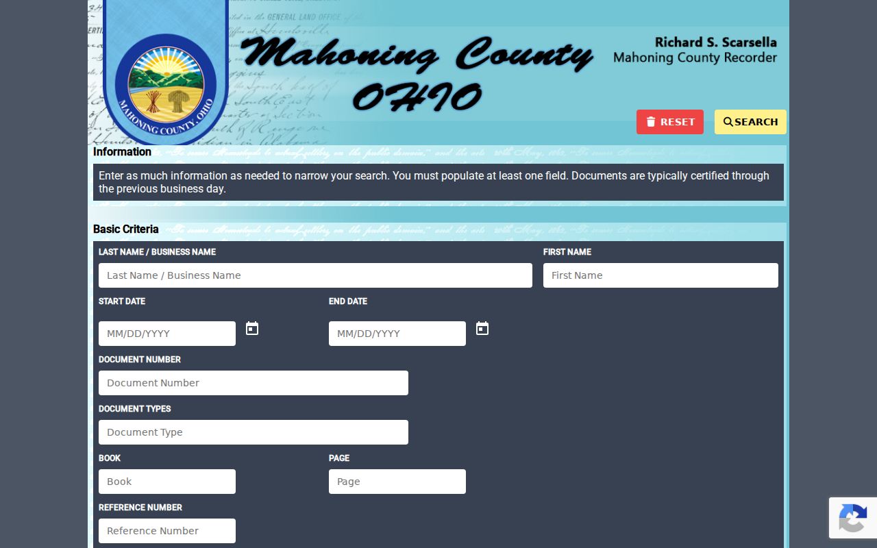
Once the document information is known, online printing or a counter copy can support the parcel trail; an address alone should not replace the legal-description comparison.
Austintown Township Street Directory History
Historical street research needs locality checks before it needs a surname search. The 1886–87 Polk Youngstown directory includes separate Austintown and West Austintown sections, a useful documented example of local scope. It does not mean every Youngstown directory volume covers the township. The Historical Society lists Youngstown directories from 1869, 1872, 1875/76, and 1877 forward, but many volumes are city-only. Check the individual edition before treating it as a street source.
- Parcel
- A county property unit identified by a parcel number and linked to a location and legal description.
- Situs address
- The property’s physical location, distinct from a deeded-owner or tax-payer mailing address.
- Plat
- A recorded plan or map used with a legal description to identify lots, blocks, or a subdivision change.
- Criss-cross directory
- A reverse directory arranged by address rather than only by name; coverage and edition scope must be checked.
For pre-1846 material, Austintown’s jurisdictional history adds one more caution: it was part of Trumbull County before Mahoning County formed. Search the historical locality label, township, road intersection, legal description, and the relevant county before deciding that a missing street entry means no record exists.
Austintown Township Street Privacy Limits
A parcel and document trail can use publicly available records, but it cannot lawfully fill the gaps with private data. Auditor fields identify recorded owners and tax contacts, not all occupants. Ohio voter records have public portions, but Ohio Rev. Code § 3503.13 excludes sensitive identifiers and confidential records. Safe at Home participants can have protected voter and address information; a public nonmatch may be an intentional protection, not a research error.
Lawful use. Use Austintown Township street records for personal, lawful research such as family history, estate questions, property curiosity, civic transparency, or scam checking. Do not use parcel, voter, or historical material to stalk, harass, intimidate, or expose someone; Ohio’s menacing-by-stalking and telecommunications-harassment laws apply.
When a record appears wrong, ask the office that holds it to explain its correction procedure. The Auditor controls parcel and tax facts, the Recorder controls recorded instruments and index procedures, and the Board of Elections controls voter records. Ohio’s Public Records Act permits inspection and copies of public records while allowing legally required redactions. Note: keep source dates and document references with a street search so a later record can be checked against its custodian.